Inspect Smarter.
Report faster.
Plan Better.
ParInspect is Parsons' browser-based platform that turns drone collected inspection imagery and models into a living record of infrastructure health.
Smart Drone
Inspections
Powered by ParInspect
Inspections
made smarter.
Parsons' browser-based platform that turns drone collected inspection imagery and models into a living record of infrastructure health. Powered by the Spatial Context Engine, it anchors every photo to its exact location in a 3D model, creating context that static reports and folders can't provide.
Single Evolving View
Accessible to both owners and inspectors for reliable data.
Clearer Reporting
Fast, accurate data propagation across all platform views.
How the Spatial Context Engine Works
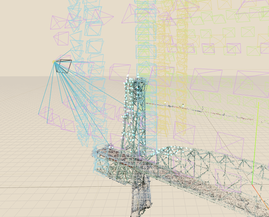
Anchoring every inspection photo to its exact position within a digital representation—point clouds, mesh, BIM, or digital twins.
1. Finder
Virtual Inspection Mode
Select an area within the model to view relevant inspection photos. The engine accounts for structural obstructions, so only relevant, unobstructed images appear when selecting points.

2. Point of View
Virtual Inspection Mode
Browse through photos to identify points of interest within the model. The engine automatically aligns camera geometry and line-of-sight data to the selected photo's field of view.

Why Owners Choose ParInspect
For asset owners, inspection data often ends up scattered across static reports and inconsistent photo folders—making it difficult to track issues over time or connect findings to specific components.
A spatial, year-over-year record gives owners a clear picture of infrastructure evolution.
Custom metrics that align with organizational priorities and extend asset lifecycles.
Why Inspectors Use ParInspect
Inspectors need close-up imagery to spot defects, but without spatial context, the photos are of limited use. ParInspect solves this by placing every image within the anchored 3D model.
Link image pixels to exact points on a model using metadata, telemetry, and automated alignment.
Builds on existing models—no need to start from scratch—saving significant time in review.
Inspect Smarter
with ParInspect
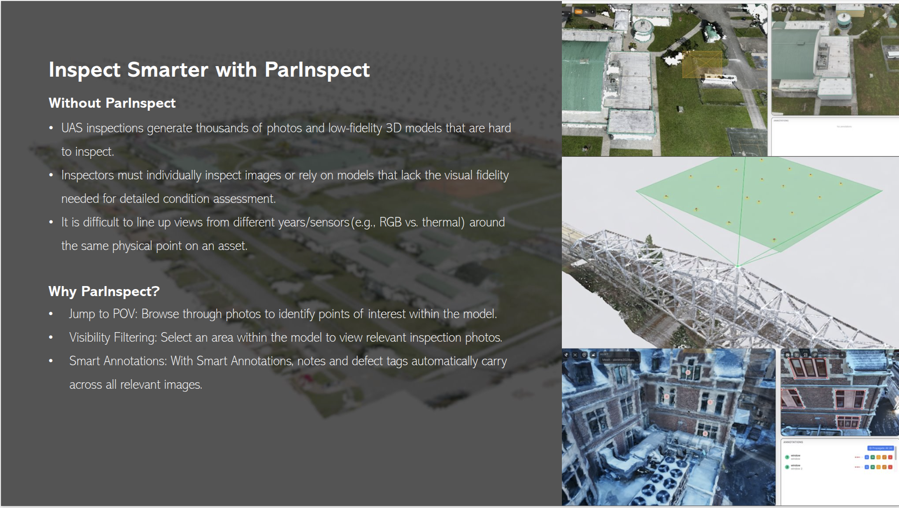
Browse through photos to identify points of interest within the model.
Select an area within the model to view relevant inspection photos.
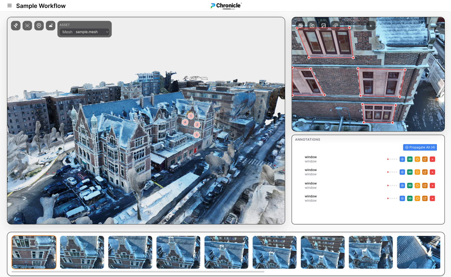
Notes and defect tags automatically carry across all relevant images, training localized ML models to flag similar defects over time.